


Chetopa Township Voting District, Wilson County, Kansas
About
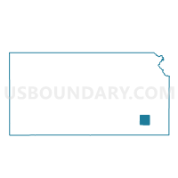
Outline

Summary
| Unique Area Identifier | 587637 |
| Name | Chetopa Township Voting District |
| County | Wilson County |
| State | Kansas |
| Area (square miles) | 35.83 |
| Land Area (square miles) | 35.65 |
| Water Area (square miles) | 0.18 |
| % of Land Area | 99.51 |
| % of Water Area | 0.49 |
| Latitude of the Internal Point | 37.52354600 |
| Longtitude of the Internal Point | -95.58661870 |
Maps


Graphs
Select a template below for downloading or customizing gragh for Chetopa Township Voting District, Wilson County, Kansas


Neighbors
Neighoring Voting District (by Name) Neighboring Voting District on the Map
- Canville Township Voting District, Neosho County, KS
- Cedar Township Voting District, Wilson County, KS
- Chetopa Township Voting District, Neosho County, KS
- Neodesha Township Voting District, Wilson County, KS
- Newark Township Voting District, Wilson County, KS
- Pleasant Valley Township Voting District, Wilson County, KS
- Shiloh Township Voting District, Neosho County, KS
Top 10 Neighboring County Subdivision (by Population) Neighboring County Subdivision on the Map
- Chetopa township, Neosho County, KS (861)
- Cedar township, Wilson County, KS (613)
- Neodesha township, Wilson County, KS (563)
- Canville township, Neosho County, KS (550)
- Shiloh township, Neosho County, KS (447)
- Newark township, Wilson County, KS (271)
- Pleasant Valley township, Wilson County, KS (219)
- Chetopa township, Wilson County, KS (162)
Top 10 Neighboring Unified School District (by Population) Neighboring Unified School District on the Map
- Chanute Public Schools Unified School District 413, KS (10,976)
- Cherryvale Unified School District 447, KS (4,268)
- Erie Unified School District 101, KS (3,628)
- Neodesha Unified School District 461, KS (3,573)
- Altoona-Midway Unified School District 387, KS (1,663)